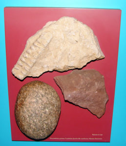
Billions of years before the St. Marys River was created, geological activity shaped and sculpted the area, which is grouped by geologists into three periods:
- Precambrian – the “basement” or earliest rocks up to 3 billion years old;
- The layered rocks on top laid down during the Paleozoic, Mesozoic, and Cenozoic eras, beginning 600 million years ago; and
- The glacial or Pleistocene activities, occurring only 20,000 to 8,000 years ago.
Beginning 3 billion years ago, this area was host to a series of volcanic episodes, shallow seas leaving sediments behind, erosion, and mountain building, as the earth’s crust warped and buckled, faulted and slipped, and tilted. Iron and copper ores, granites and quartzites were formed. In some areas of the Upper Peninsula of Michigan, Precambrian era rocks occur at the surface, exposed when glaciers 10,000 years ago pushed away any materials which were left on top during that last 600 million years.
During the Cambrian era, 550 million years ago, sands hardened into a red stone, now called Jacobsville sandstone. This rock layer was encountered during construction of the locks and canal in the 1850s and used to construct buildings throughout the area. Then came the salt seas over the region, which laid down layers of sediments filled with marine invertebrates during the Ordovician era. Dolomites and limestones, prominent rock type in this region, were formed during the Silurian and Devonian eras. Fossilized brachiopods and corals are found in layers of this hardened sediment.
Marine deposition ended 220 million years ago with the final withdrawal of the sea. The Mesozoic and Cenozoid eras were times of erosion. It removed much of the previously deposited Paleozoic rocks, which were soft sedimentary deposits of hardened clays and silts. Much of the geologic evidence since the end of the Silurian until the Pleistocene era is missing or fragmentary due to this erosion. In other regions of North America, this period witnessed the origin of flowering plants, dinosaurs, birds, primates, and reptiles.
Glaciers Shaped the Landscape
The glacial or Pleistocene era began about 2 million years ago. This is a relatively recent date compared to the 3 billion year old rocks of the Precambrian times. Glaciers do not form rocks, but move and reshape the landscape by pushing soil and stones within and in front of the ice formation. For a glacier to form, there must be adequate snowfall and sufficiently cold temperatures, so that the snow that falls each year does not melt. It accumulates and its own weight, with the sun’s rays, put pressure on the lower layers, compacting it into ice.
The glacial ice sheet, up to one mile thick, pushed and scraped against the Precambrian and other rock features, as the softer rock was scoured away and redeposited elsewhere. As the glacier advanced or moved southward, it picked up loose rocks, trees and vegetation, incorporating and relocating materials to other places. In part, the ice pack moved southward because the immense weight at the front “squeezed” the ice flow towards the path of least resistance. As the glacial ice mass melted during warmer periods, the rock material in front of it was left behind, forming ridges, hills, valleys, and a layer of glacial “drift” or all the rock and soil left in layers or concentrated deposits.
The direction of glaciers can be tracked by “chatter marks” which are created when a boulder in the glacier presses against the harder base rock as the boulder is carried across the underlying deposit. This area was covered by at least four successive glacial ice packs. Each “retreat” or melting of the front, brought on by a warming trend or decreased snowfall, left behind a variety of melt-water lake configurations. Much of modern-day Michigan was once underwater, with water depths in this area as much as 40 feet higher than today’s lake levels.
A River is Formed
Around 10,000 years ago, the glacial ice sheet melted off the lower area of Michigan. By 8,000 years ago, it was gone from northern Michigan. The configuration of the Great Lakes has been basically the same for the last 5,000 years. As the ice melted and glacier receded, the trees, plants, animals, and man adapted to the newly created and exposed environment.
The weight of the glacial ice caused the earth’s crust to depress or pushed downwards, in some places of northern Ontario, by as much as 3,000 feet. When the glaciers melted and the weight was removed, the crust began to rebound or move back upwards. It still is moving upwards today by an estimated 1 inch per 100 years.
The St. Marys River links Lake Superior with Lake Huron with the water level of Lake Superior 21 feet higher than that of Lake Huron. The St. Marys River drops over a distance of less than half a mile. The roar of this water once cascading over boulders and bedrock left exposed after the glaciers carved the path between the Lakes. The River, the different lake levels, the rapids, and hundreds of islands which dot the St. Marys River are all clues which tell the tale of the dynamic and ever-changing landscape formed during the last 3 billion years.
When you stand on the banks of the St. Marys River, try to imagine what it was like in the past.


